11 UPHAM HILL RD
Owner Information
ROUFAIL AMIR E (4/06)
11 UPHAM HILL RD
CHARLTON, MA 01507


Property Details
11 UPHAM HILL RD is classified as a Single Family Residential (Colonial).
The primary structure on this property was built in 2005. There are 2,436ft2 of built area within this property. There is 2,436ft2 of residential/living space within this property. This property is listed as having 8 rooms.
11 UPHAM HILL RD is valued at $427,300. The land is valued at $74,300 and the structures are valued at $353,000.
The most recent deed for 11 UPHAM HILL RD is recorded at the local registrar in Book 38739, Page 23. 11 UPHAM HILL RD was last sold on Tuesday, April 11, 2006 for $369,900.
Assessment data from fiscal year 2022.
Flood Data
According to the FEMA National Flood Hazard Layer, this property does not appear to be in a flood zone. It may also be in an area not yet reviewed. Nonetheless, confirm this information prior to taking any action.
To view the flood hazards around this property, create a FEMA "Firmette" Map of the area around 11 UPHAM HILL RD.
Broadband Internet Providers
| Provider | Type | Bandwidth (mbps) | |
|---|---|---|---|
| Charter Communications Inc | Cable | 940 | 35 |
| Crown Castle Fiber | Fiber | 0 | 0 |
| Viasat Inc | Satellite | 100 | 3 |
| Verizon New England Inc. | DSL | 0 | 0 |
| T-Mobile | Fixed Wireless | 25 | 3 |
| GCI Communication Corp. | Satellite | 0 | 0 |
| HughesNet | Satellite | 25 | 3 |
| VSAT Systems, LLC. | Satellite | 2 | 1 |
Broadband service provider data from December 2020.
Adjacent Properties
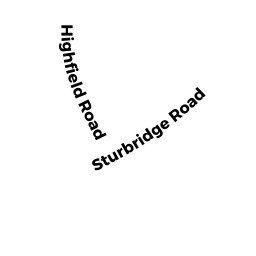
- 0 HIGHFIELD RD
Potentially Developable Residential Land owned by EVANS ROBERT S (9/17) - 13 HIGHFIELD RD
Single Family Residential owned by FORGET ANTHONY (7/11) - 298 STURBRIDGE RD
Single Family Residential owned by THE DONALD HUGH ANDERSON - 304 STURBRIDGE RD
Undevelopable Residential Land owned by PRIDE DEVELOPMENT (3/02) - 0 UPHAM HILL RD
Potentially Developable Residential Land owned by PRIDE DEVELOPMENT (3/02)